Before And After: A Decade Of Change On Earth As Seen From Space
The world changed in many ways in the second decade of the 21st century. Satellite firm Maxar Technologies has used its satellite imagery to document how the Earth's surface has been impacted by events between 2010 and 2019. (Drag the slide button to reveal before and after)
Before
After

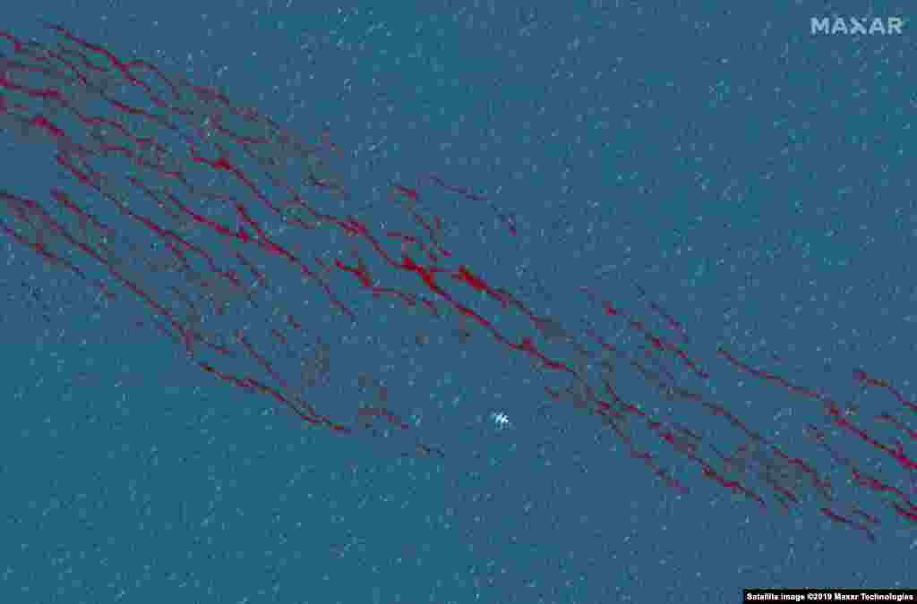
1
The Deepwater Horizon oil spill in the Gulf of Mexico was the largest marine oil spill in history. An explosion on April 20, 2010 destroyed the BP rig, causing more than 3 million barrels of oil to be released in the gulf over the next 87 days. These dramatic satellite images show large patches of oil, some of which are being burned off as part of mitigation efforts. Images were taken on April 26, 2010 and June 20, 2010.
Before
After

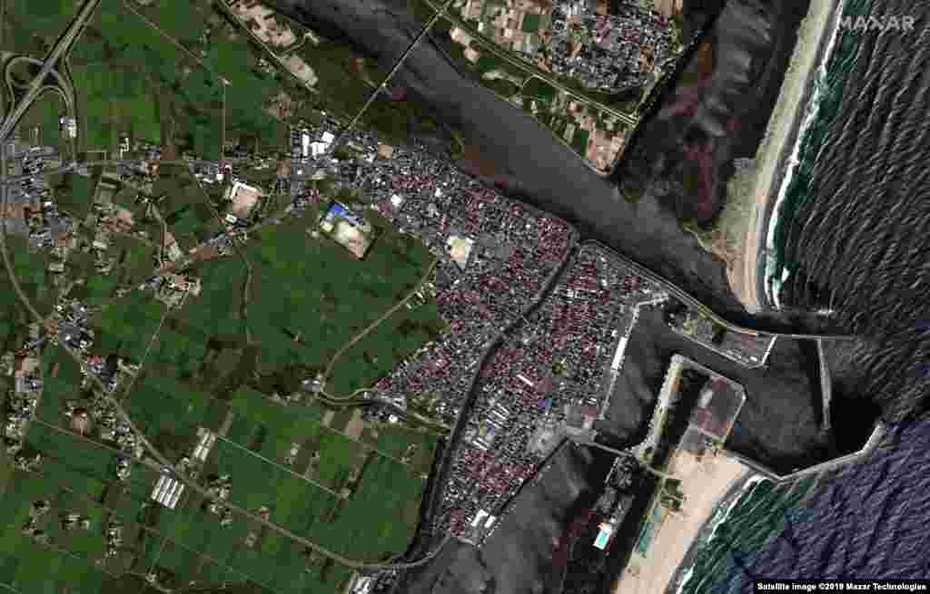
2
Satellite images show the destruction left by the tsunami in Hiroura Bay, outside Sendai, Japan. A 9.0 magnitude, six-minute-long earthquake in Japan triggered a massive tsunami on March 11, 2011. The tsunami brought waves as high as 40 meters in some areas, leaving ships on land, destroying villages, and flooding farmland. The images were taken on August 23, 2010 and March 11, 2011.
Before

After
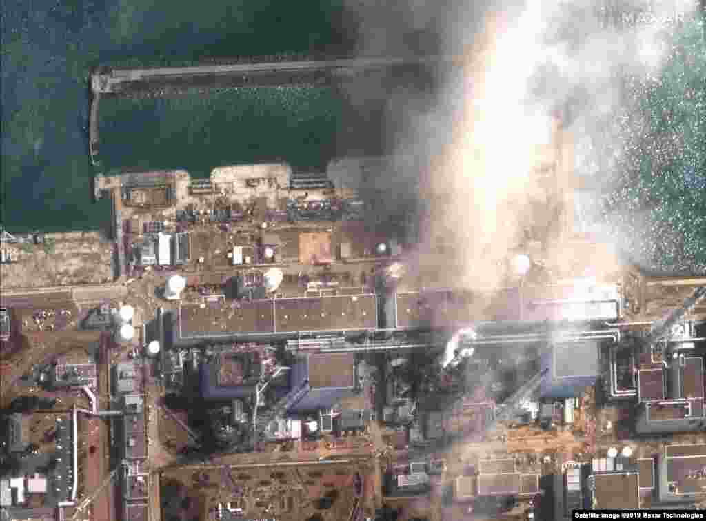
3
When the tsunami came ashore at the Fukushima Daiichi Nuclear Power Plant, the wave came over the seawall. This caused the cooling systems of three nuclear reactors to shut down, spurring a catastrophe that sent radiation into the surrounding area. The first image shows the power plant one minute before the second reactor exploded on March 14, 2011. The second image, collected four minutes after the first image, shows the explosion damage to the second reactor.
Before

After

4
Since announcing its Belt and Road Initiative in 2013, China has embarked on an aggressive global expansion, investing in infrastructure projects around the world to strengthen political alliances and gain access to emerging markets. China has expanded its military footprint as well, turning remote coral reefs in the contested South China Sea into islands capable of hosting Chinese naval vessels and aircraft. These Maxar images show the build-up of Fiery Cross Reef from 2013 to 2017.
Before
After
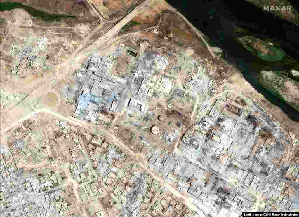
5
These satellite images show a hospital and hotel in Mosul, Iraq on November 13, 2015, before Islamic State (IS) militants invaded the city and then the same area on July 8, 2017, after IS destroyed much of this part of the city. U.S.-led coalition forces battled the militants, liberating IS-held territory by March 2019.
Before
After

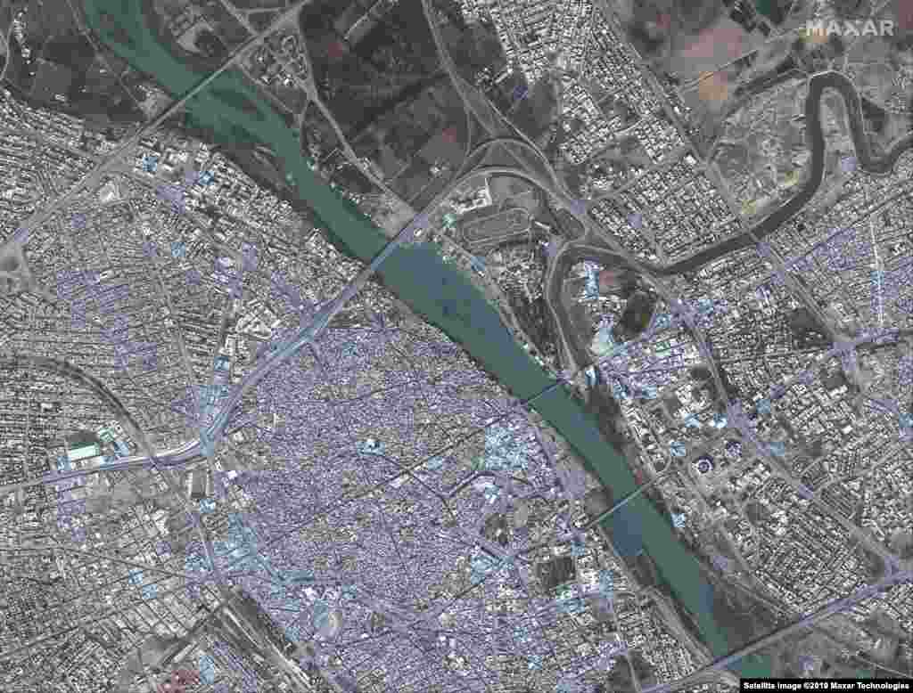
6
These satellite images show Mosul, Iraq on November 13, 2015, before IS militants invaded the city and the same area on July 8, 2017, after IS destroyed much of this part of the city.
Before

After

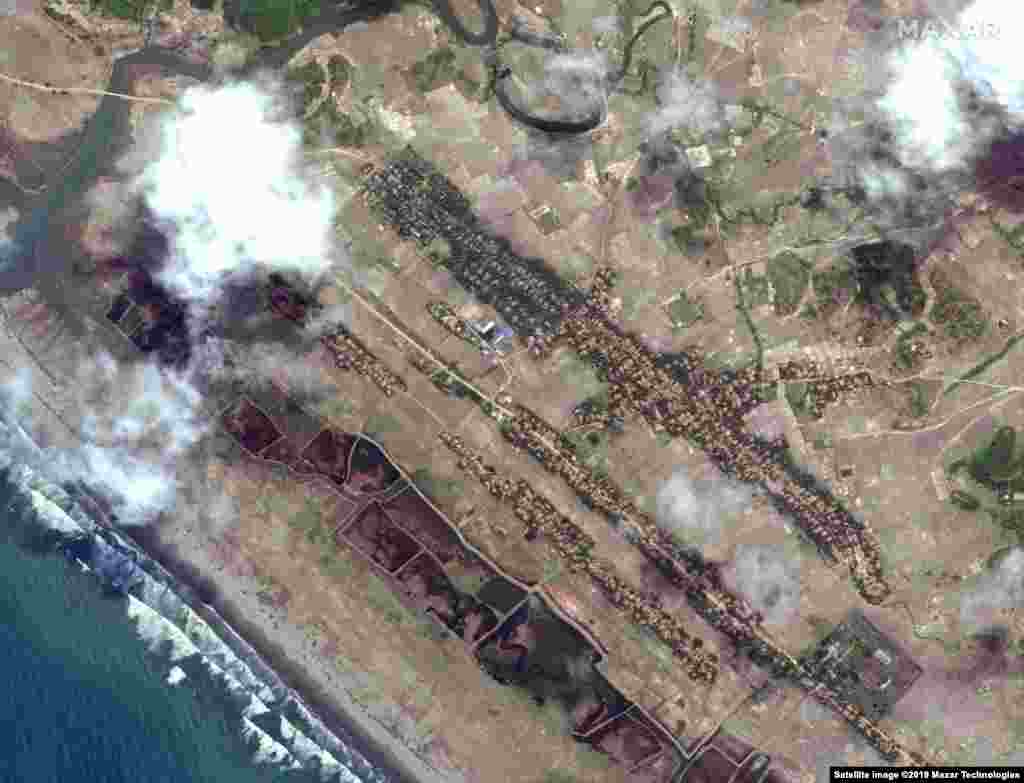
7
Hurricane Harvey slammed into the Texas coastline as a Category 4 storm on August 25, 2017, causing significant flooding in and around Houston. The storm resulted in $125 billion in damage -- the most expensive disaster in 2017. These first two images show flooding in Holiday Lakes, Texas, outside Houston. The images show Holiday Lakes, Texas on April 3, 2017 and then August 30, 2017.
Before
After

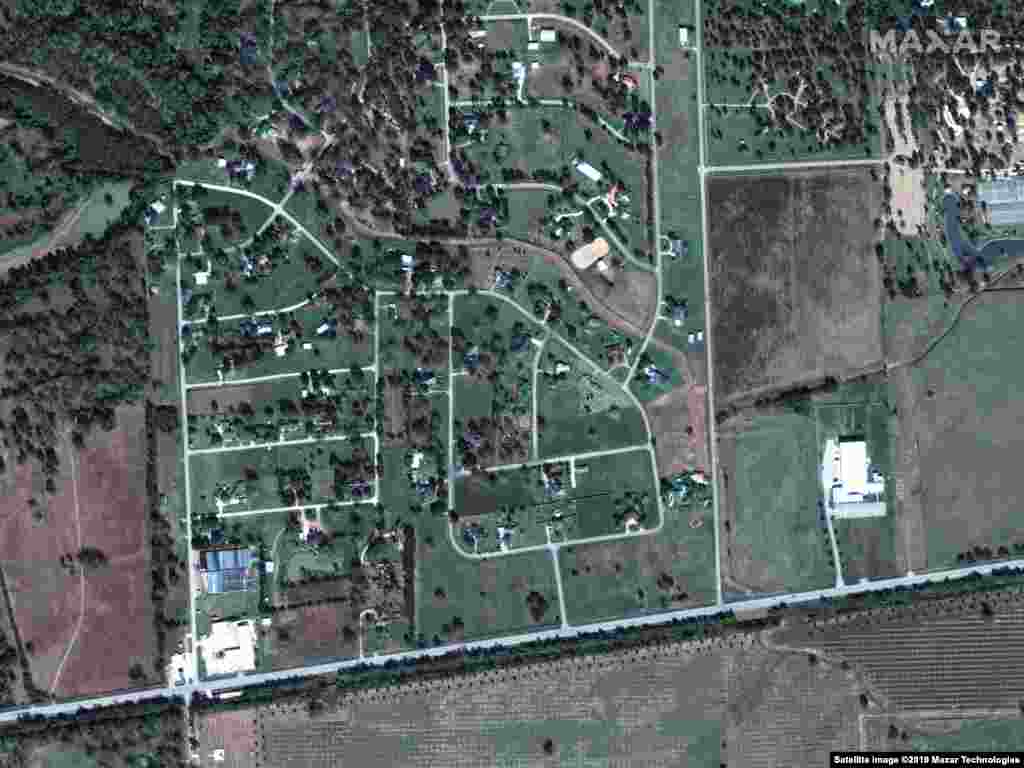
8
Satellite images show the town of Simonton, Texas, before and after Hurricane Harvey on November 20, 2016 and August 30, 2017.
Before

After

9
Hurricane Irma ripped through the Caribbean as a Category 5 storm and hit Florida as a Category 4 storm before moving up the U.S. East Coast in September 2017. These satellite images highlight the damage Irma caused to Anse Marcel, a popular beach on the island of St. Martin (before image taken on Aug. 25, 2016; after image collected on Sept. 11, 2017). Several of the Caribbean islands reported that most homes and buildings had been destroyed, leaving the islands uninhabitable until they could be rebuilt.
Before

After

10
Hurricane Maria swept through the U.S. Virgin Islands as a Category 5 storm then moved to Puerto Rico as a Category 4. Most of these islands were left without power and adequate supplies. These images show buildings in Bayamon on May 12, 2017 and September 24, 2017.
Before
After
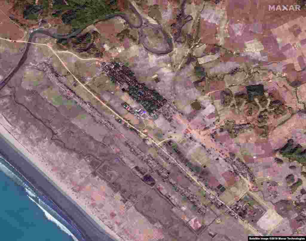
11
In the summer of 2017, the Myanmar military started a violent crackdown in Rakine State against the Rohingya, a Muslim ethnic minority. More than 900,000 Rohingya fled to neighboring Bangladesh to escape the violence. These images show how the violence affected the village of Inn Din, where the town's population was split between Rohingya Muslims and Buddhists. In the first image, from May 2017, the Rohingya lived in the brown homes before they fled the violence. The homes were burned down, then bulldozed (after image, February 2018) to make room for buildings to be constructed on the site in 2019.
Before
After
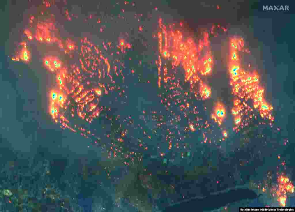
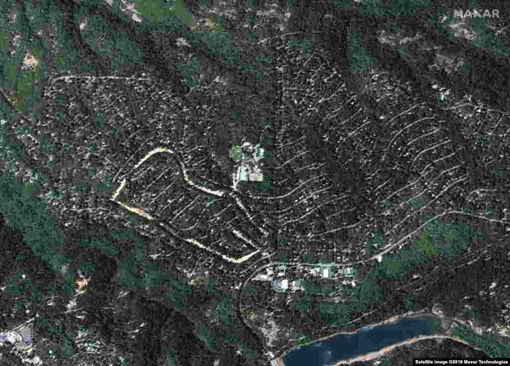
12
The past decade saw five of the most destructive global wildfire seasons ever recorded. The Camp Fire started on November 8, 2018 in northern California and devastated the community of Paradise. It became the deadliest and most destructive fire in California history, burning nearly 14,000 homes and killing 85 people. Images were taken in Paradise Pines on September 10, 2018 and November 9, 2018.
Before

After
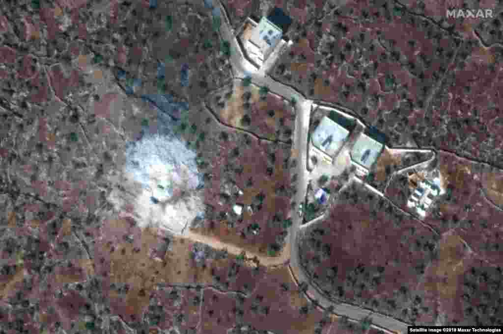
13
In November 2019, IS militant leader Abu Bakr al-Baghdadi was killed in a U.S. raid on his compound in Syria. Images show the site on September 28, 2019 and November 12, 2019.
Before
After
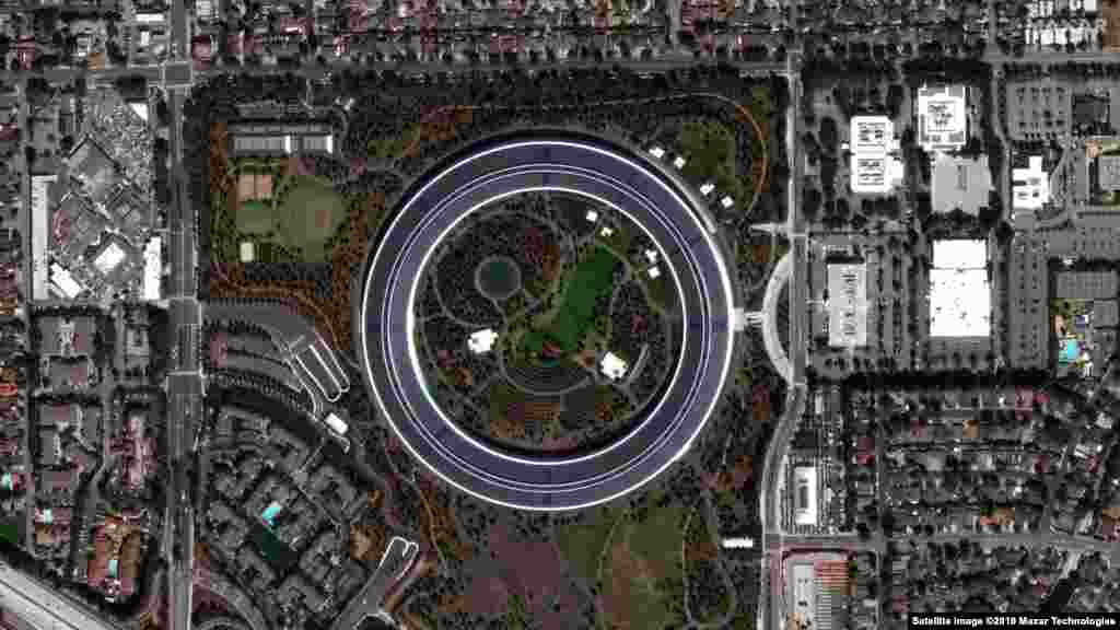
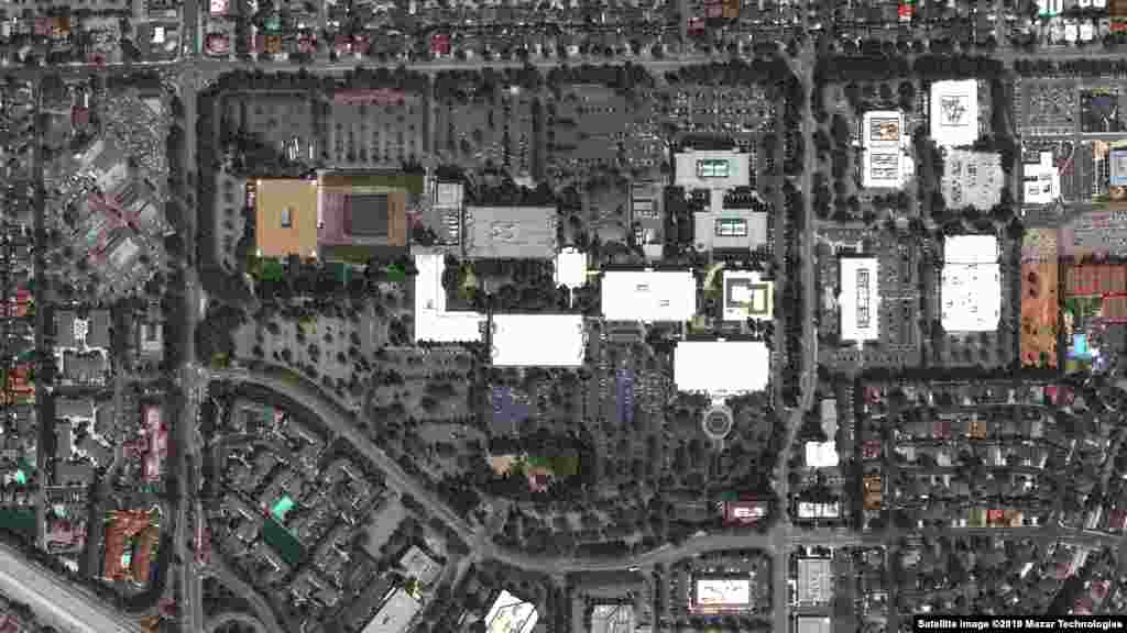
14
These images show the evolution of technology firm Apple's headquarters -- called Apple Park -- in Cupertino, California. The before image shows the former Hewlett Packard campus in 2012 followed by the construction of 260,000 square meters of new office space in Apple Park, the landscaping of about 71 hectares and regular operations in 2019. The images were taken on August 30, 2012 and September 2, 2019.